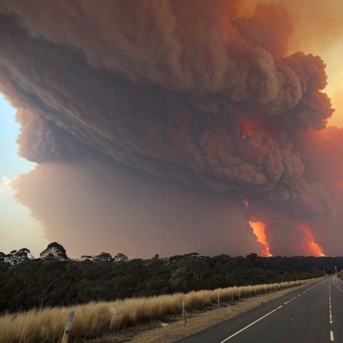
Indonesia, an archipelago of over 17,000 islands, sits precariously on the Pacific Ring of Fire, a horseshoe-shaped zone notorious for its seismic and volcanic activity. With more than 120 active volcanoes, the country faces constant threats from eruptions that can displace thousands, disrupt aviation, and alter global climates. In response, Indonesia has developed one of the world's most sophisticated volcano early warning systems, a complex network integrating science, technology, and community preparedness.
The heart of this system lies in the Center for Volcanology and Geological Hazard Mitigation (PVMBG), which operates under Indonesia's Geological Agency. Staffed by teams of dedicated volcanologists, the center maintains 24/7 monitoring of all active volcanoes through a combination of seismic sensors, gas analyzers, thermal cameras, and ground deformation instruments. These tools provide real-time data that helps scientists detect the subtle signs of magma movement that often precede eruptions.
What makes Indonesia's approach unique is its tiered alert system. The PVMBG uses a four-level color-coded scheme ranging from Normal (green) to Warning (red). This system allows for gradual escalation of precautions as volcanic activity increases. At Level 2 (Advisory), scientists intensify monitoring. Level 3 (Watch) triggers community preparedness drills, while Level 4 means immediate evacuation for at-risk populations.
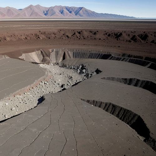
The 2010 eruption of Mount Merapi demonstrated both the strengths and limitations of the system. While warnings saved tens of thousands of lives, the volcano's unexpected ferocity still claimed over 350 victims. This tragedy led to significant improvements, including the installation of more advanced multiparameter monitoring stations that can detect a wider range of precursory signals.
Technology alone cannot protect Indonesia's volcano-vulnerable communities. The PVMBG has invested heavily in community education programs, training local residents as volcano observers and conducting regular evacuation drills. In East Java, villages near Mount Bromo have established their own early warning networks using simple tools like walkie-talkies and warning bells to complement official monitoring.
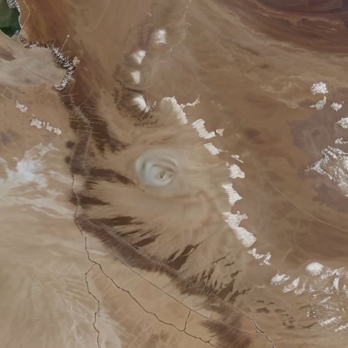
Satellite technology has become increasingly crucial for monitoring Indonesia's vast volcanic landscape. The country now utilizes data from both international satellites and its own constellation to track ground swelling, thermal anomalies, and ash plumes. This space-based perspective helps scientists monitor remote volcanoes that lack ground instruments and provides critical data during eruptions that make on-site monitoring too dangerous.
The economic implications of volcanic activity drive much of Indonesia's investment in early warning. The 2010 Merapi eruption cost an estimated $600 million in direct damages and lost productivity. More dramatically, the 2014 eruption of Mount Kelud grounded flights across Java, causing $200 million in aviation losses alone. Accurate early warnings allow businesses and transportation networks to prepare contingency plans, minimizing economic disruption.
Climate researchers also benefit from Indonesia's volcanic monitoring. The archipelago's volcanoes account for about 15% of global volcanic CO2 emissions and have historically caused significant climate perturbations. The infamous 1815 eruption of Mount Tambora led to the "Year Without a Summer" in 1816. Modern monitoring helps climate scientists better understand these impacts and improve global climate models.
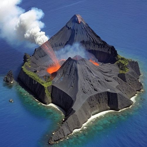
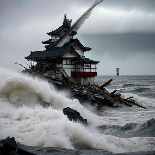
Despite these advances, challenges remain. Many monitoring stations suffer from maintenance issues in Indonesia's tropical climate, while funding shortages sometimes delay equipment upgrades. The 2018 eruption of Mount Anak Krakatau highlighted gaps in tsunami warning coordination when a flank collapse triggered deadly waves that killed hundreds along the Sunda Strait.
Looking ahead, Indonesia plans to integrate artificial intelligence into its warning systems. Machine learning algorithms are being trained to recognize patterns in seismic data that might elude human analysts, potentially providing earlier warnings. Pilot projects using drone-based gas sampling and infrared imaging show promise for monitoring extremely active volcanoes too dangerous for regular human access.
The international community closely watches Indonesia's innovations in volcanic monitoring. As climate change potentially affects volcanic activity through mechanisms like glacial unloading and increased rainfall, the lessons learned from Indonesia's comprehensive approach may prove invaluable for other volcanically active nations. The country's experience demonstrates that effective early warning requires not just advanced technology, but also strong community engagement and interagency coordination.
For Indonesia's volcano experts, the work never stops. Each day brings new data to analyze, equipment to maintain, and communities to prepare. In a nation where the ground itself can turn deadly with little warning, their vigilance provides what may be the most valuable resource of all: time to get out of harm's way when the earth begins to rumble.

By Victoria Gonzalez/Apr 14, 2025

By Samuel Cooper/Apr 14, 2025

By William Miller/Apr 14, 2025
By Emma Thompson/Apr 14, 2025

By Lily Simpson/Apr 14, 2025
By Emily Johnson/Apr 14, 2025

By George Bailey/Apr 14, 2025
By Sarah Davis/Apr 14, 2025
By Grace Cox/Apr 14, 2025
By Natalie Campbell/Apr 14, 2025
By Christopher Harris/Apr 14, 2025
By Rebecca Stewart/Apr 14, 2025

By Joshua Howard/Apr 14, 2025
By Jessica Lee/Apr 14, 2025
By Eric Ward/Apr 14, 2025

By Lily Simpson/Apr 14, 2025
By William Miller/Apr 14, 2025

By Olivia Reed/Apr 14, 2025

By William Miller/Apr 14, 2025